In this article
Most cities will tell you they’re becoming more bikeable. Los Angeles is actually doing some of the work, in two specific places, right now - and if you’re considering a move there, the geography of that work is worth understanding.
The Los Angeles Department of Transportation has opened new protected bike lanes on Lankershim Boulevard in North Hollywood, on Broadway Place near Exposition Park, and has preliminary markings going down on 39th Street in South L.A. These aren’t grand gestures. They’re a quarter mile here, a few blocks there. But they connect to things.
North Hollywood: The Lankershim Lane
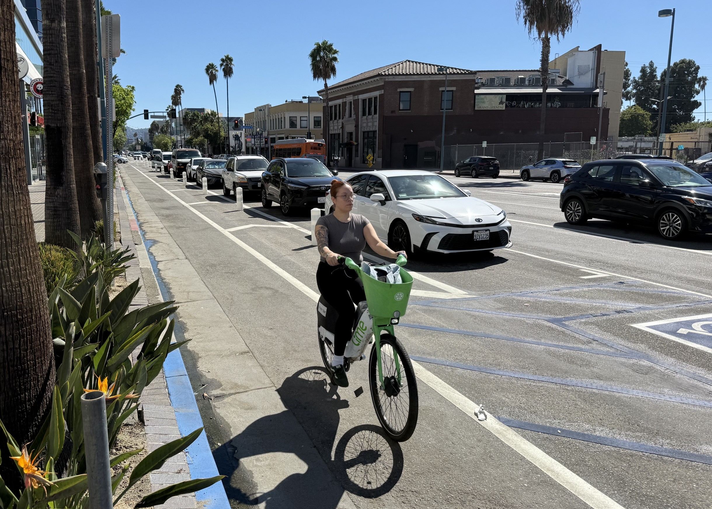
The Lankershim installation runs about a quarter mile northbound, from Magnolia Boulevard to Chandler Boulevard (south). It’s a parking-protected lane - meaning a row of parked cars sits between the bike lane and moving traffic, which is the configuration that actually gets people to use bike infrastructure rather than just photograph it.
What makes the location meaningful rather than arbitrary: it sits immediately south of the Metro B Line and G Line North Hollywood Station. That’s the junction where the Red Line subway terminates and the Orange Line busway - now the G Line, a bus rapid transit route - heads west toward the San Fernando Valley. The new bike lane doesn’t transform North Hollywood into Amsterdam. What it does is connect the station to a short stretch of Lankershim that had no safe cycling option before.
North Hollywood has spent years as the less-talked-about end of the NoHo Arts District branding push. Rents along Lankershim and its side streets tend to run lower than in Silver Lake or Los Feliz, with two-bedroom apartments commonly available in the $2,000 - $2,600 range depending on the building and the block - though that gap has been narrowing. The transit access is genuinely good by Los Angeles standards: you can reach downtown in under 30 minutes on the B Line without touching a freeway. The new bike lane, modest as it is, makes the last-mile connection between that station and the surrounding blocks slightly less hostile.
It’s worth noting that this Lankershim segment wasn’t part of the original Chandler Boulevard project as presented in 2021. It got added. That kind of quiet scope expansion is usually how street projects actually improve - not through announcements but through revisions that nobody headlines.
South L.A.: The MLK Corridor
The second cluster of new infrastructure sits in South Los Angeles, just east of Exposition Park. LADOT calls it the Martin Luther King Jr. Blvd Safety and Mobility Project, and the new protected lanes on Broadway Place and 39th Street are the current visible output.
The project has a complicated lineage. Metro funded it in 2021, at which point it included planned bike lanes on Avalon Boulevard and Gage Avenue. Those were later dropped. Broadway Place and 39th Street were substituted in. LADOT had already upgraded existing bike lanes on MLK Boulevard earlier this year; the Broadway Place and 39th Street additions are the next layer.
When Streetsblog visited last week, the Broadway Place lanes were mostly complete. The 39th Street work was still in progress - preliminary markings laid down, some cars still parked in sections of the not-yet-finished lane.
That kind of half-finished state is useful to see honestly rather than spin. A bike lane with cars parked in it is not yet a bike lane. It’s a promise with paperwork.
What This Actually Means If You’re Moving
Here’s the relocation-relevant question: does any of this change whether South L.A. or North Hollywood should be on your list?
Carefully, yes - in one specific way.
Protected bike infrastructure in Los Angeles has historically been concentrated west of the 110, in neighborhoods that were already attracting investment: Silver Lake, Echo Park, Mid-City. The MLK corridor project extends that investment east and south, into neighborhoods where the transportation calculus has long been worse. Exposition Park itself is worth noting - it’s adjacent to the Natural History Museum, the California Science Center, and USC’s campus - but the surrounding streets have operated for years as if pedestrians and cyclists were afterthoughts.
Neither of these projects makes car-free living viable in these neighborhoods. Los Angeles is not that city yet, and pretending otherwise would be a disservice. But for someone who bikes regularly and is willing to combine cycling with Metro rail - particularly on the north-south B Line or the east-west E Line, which runs along Exposition Boulevard - these additions matter at the margins.
The margin question in L.A. is usually: can I get to the things I need without spending two hours in a car? In North Hollywood, near a Metro station with a new protected connection, the answer is improving. In South L.A. near Expo Park, it’s improving more slowly, but it’s moving in a direction it wasn’t moving five years ago.
The 39th Street lane isn’t finished. Somebody will still park in it on Tuesday.